Zoning is the legal framework that controls what you can build on a piece of land and how you can use it. Before you sign a purchase agreement, zoning determines whether you can put a home there, run a business, farm the land, or do nothing at all. Get it wrong, and you could own a parcel that doesn’t serve your purpose.
This guide covers every major zoning classification, how to read a zoning map, what happens when you need an exception, and how zoning directly shapes the market value of raw land.
Key Takeaways
- Zoning controls land use — it determines what can legally be built or operated on any given parcel before you buy.
- There are four core zoning types — residential, commercial, agricultural, and industrial, with mixed-use as a hybrid category.
- Zoning maps are public records — most counties and municipalities post them online, and you can verify a parcel’s classification before making an offer.
- Variances and rezoning are two different tools — a variance bends existing rules; rezoning changes the classification entirely.
- Zoning directly affects land value — commercially zoned land typically sells for significantly more per acre than agriculturally zoned land in the same area.
- Deed restrictions can add limits beyond zoning — private covenants on a property can be more restrictive than local zoning codes.
What Is Zoning and Why Does It Matter for Land Buyers?

Quick Answer: Zoning is a local government system that divides land into designated use categories. It controls what structures you can build, what activities you can conduct, and how dense development can be. Buying land without checking its zoning is one of the most costly mistakes a buyer can make.
Local governments — typically counties, cities, or townships — create zoning ordinances to manage how land is used within their jurisdiction. These rules are written into law and enforced through permits, inspections, and fines.
Every parcel of land carries a zoning designation. That designation dictates lot size minimums, building setbacks, height limits, permitted uses, and conditional uses. A parcel might look perfect for your plans, but if the zoning doesn’t allow your intended use, you either need an exemption or a different parcel.
Zoning also affects your financing options. Lenders look at zoning classification to assess land risk. A parcel zoned for commercial development may qualify for different loan products than one zoned agricultural.
Who Controls Zoning Decisions?
Zoning authority sits with local governments, not the federal government. Cities have planning departments that write and enforce zoning codes. In unincorporated areas, counties take that role. Some regions also have regional planning agencies that coordinate zoning across multiple jurisdictions.
The local planning board or zoning commission is the body that approves changes, hears variance requests, and updates the zoning map. Understanding who controls this process matters if you ever need to pursue rezoning.
What Are the Main Zoning Classifications for Land?
Quick Answer: The four primary zoning classifications are residential, commercial, agricultural, and industrial. Each one allows specific uses and restricts others. Mixed-use zoning blends two or more of these categories on a single parcel or district.
Residential Zoning
Residential zoning is designed for housing. It covers everything from single-family homes on large lots to high-density apartment complexes. Subcategories like R-1, R-2, and R-3 indicate density levels — R-1 typically means one unit per lot, while R-3 allows multi-family buildings.
Residential zoning also includes rules about accessory dwelling units (ADUs), home-based businesses, and short-term rentals. These rules vary widely by city, so checking the specific ordinance matters.
Commercial Zoning
Commercial zoning allows businesses, retail stores, offices, restaurants, and service operations. Like residential zones, commercial zones have subcategories. A C-1 zone might allow small neighborhood shops, while a C-3 zone could permit large retail centers or auto dealerships.
Commercial land is typically more valuable per acre than residential or agricultural land because it generates higher potential revenue for the owner or tenant.
Agricultural Zoning
Agricultural zoning protects farmland from development pressure. It allows crop farming, livestock operations, vineyards, orchards, and related structures like barns and silos. Most agricultural zones restrict residential density to prevent subdivision into small residential lots.
Some agricultural zones allow farm worker housing or agritourism, but these uses usually require a conditional use permit (CUP) — a special approval granted by the local planning board.
Industrial Zoning
Industrial zoning accommodates manufacturing, warehousing, distribution centers, and heavy equipment operations. Light industrial (I-1) zones allow smaller-scale production and storage. Heavy industrial (I-2 or I-3) zones permit facilities with significant noise, emissions, or environmental impact.
Industrial land near transportation corridors — highways, rail lines, ports — commands a premium because logistics and supply chain operations depend on access.
Mixed-Use Zoning
Mixed-use zoning combines residential and commercial uses in a single district or building. A mixed-use parcel might allow ground-floor retail with apartments above. These zones are common in urban infill projects and planned developments.
Mixed-use classifications can be highly valuable because they open more revenue streams from a single parcel. But they also come with more complex permitting requirements.
How Do Zoning EAV Classifications Compare Across Key Attributes?
Quick Answer: Zoning classifications differ in allowed uses, typical lot sizes, density limits, and average land values. Comparing these attributes side by side helps buyers quickly assess whether a parcel fits their goals and budget.
| Zoning Type | Typical Use | Min. Lot Size (Common Range) | Density | Avg. Land Value vs. Agricultural Baseline | Common Subcategories |
|---|---|---|---|---|---|
| Residential (R-1) | Single-family homes | 6,000–20,000 sq ft | 1 unit per lot | 3x–8x | R-1, R-2, R-3, R-4 |
| Commercial (C-1 to C-3) | Retail, offices, restaurants | 5,000–30,000 sq ft | Floor-area ratio (FAR) based | 5x–20x | C-1, C-2, C-3, B-1 |
| Agricultural (A-1) | Farming, livestock, crops | 5–40 acres | Very low (1 home per 20+ acres) | Baseline (1x) | A-1, A-2, AG |
| Industrial (I-1 to I-3) | Manufacturing, warehousing | 10,000–5 acres | High coverage ratios, low residential | 4x–15x | I-1, I-2, I-3, M-1 |
| Mixed-Use (MU) | Retail + residential combined | 3,000–15,000 sq ft | Moderate to high | 6x–18x | MU-1, MU-2, TOD (Transit-Oriented) |
How Do You Read a Zoning Map Before Buying Land?

Quick Answer: To read a zoning map, locate the parcel using its address or APN (assessor’s parcel number), identify the color-coded zone designation, then cross-reference that designation with the municipality’s zoning code to see permitted uses, setbacks, and height limits.
Most counties and cities publish interactive zoning maps online through their planning department or GIS (geographic information system) portal. You can search by address or parcel number and pull up the zone designation within minutes.
Step-by-Step: Reading a Zoning Map
- Find the parcel’s APN. The assessor’s parcel number is a unique ID for every land parcel. You can find it on the county assessor’s website or the property’s tax records.
- Access the zoning GIS map. Search your county or city name plus “zoning map” or “parcel viewer.” Most municipalities have a free public portal.
- Locate the parcel. Enter the APN or street address. The parcel will highlight on the map and show its current zoning designation (example: R-1, C-2, A-1).
- Read the zoning code. Once you have the designation, find the corresponding section of the zoning ordinance. This lists every permitted use, conditional use, setback requirement, and height limit for that zone.
- Check the overlay zones. Some parcels sit within overlay districts — flood plains, historic preservation zones, coastal zones, or airport influence areas. These add restrictions on top of the base zoning.
- Confirm with the planning department. If anything is unclear, call the local planning department and request a pre-application meeting. They can give you a written confirmation of the parcel’s allowed uses.
What Are Overlay Zones and Why Do They Matter?
An overlay zone is an additional layer of zoning regulations applied on top of a base zone. Common overlays include FEMA flood zones, wildfire hazard areas, scenic corridor zones, and groundwater protection districts. A parcel might be zoned residential but sit in a FEMA 100-year flood zone — which could require elevated construction, flood insurance, and special permits.
Always check for overlay zones. They can significantly raise your development costs or block certain uses entirely.
What Key Zoning Attributes Should Buyers Verify Before Purchase?
Quick Answer: Before buying land, verify the zoning classification, permitted and conditional uses, setback requirements, maximum building height, minimum lot size, utility access rules, and whether any overlay zones apply. These attributes directly control what you can build and how much it will cost.
| Zoning Attribute | What It Controls | Why Buyers Must Check It | Where to Find It |
|---|---|---|---|
| Permitted Uses | Activities allowed by right | Determines if your intended use is legal | Local zoning ordinance |
| Conditional Uses | Activities needing a CUP | Requires separate approval process | Local zoning ordinance + planning board |
| Setback Requirements | Min. distance from property lines | Limits where you can place structures | Zoning code for each zone |
| Height Limits | Max. building height | Constrains multi-story development | Zoning code; typically 25–65 ft residential |
| Lot Coverage Ratio | % of lot that can be built on | Restricts total footprint of structures | Zoning code; typically 30–60% |
| Overlay Zones | Additional restrictions layered on top | Can block uses or raise costs sharply | GIS maps, flood maps (FEMA), county records |
What Is the Difference Between a Variance and Rezoning?

Quick Answer: A variance is a one-time exception to a specific zoning rule without changing the zone classification. Rezoning changes the parcel’s classification permanently. Variances are faster and easier to get. Rezoning takes longer, costs more, and requires broader government approval.
How Do You Apply for a Zoning Variance?
A variance is a request to deviate from one specific rule — like building 10 feet from the property line instead of the required 20 feet. You apply to the local zoning board of appeals (ZBA). The board evaluates whether strict application of the rule creates an unreasonable hardship for you as the property owner.
To win a variance, you typically need to prove three things: the hardship is unique to your parcel (not a general complaint about the rule), the variance won’t negatively impact neighboring properties, and the proposed use is consistent with the general intent of the zoning district.
Variance Application Process
- Submit a written application to the ZBA with site plans and supporting documents.
- Pay the application fee — typically $250 to $1,500 depending on the municipality.
- Attend a public hearing where neighbors and the board can ask questions.
- Receive a decision — approval, approval with conditions, or denial.
- If denied, you can appeal to a higher court or local governing body.
How Does Rezoning Work?
Rezoning changes a parcel’s official zoning designation. A landowner submits a rezoning petition to the local planning commission. The commission reviews it against the municipality’s general plan (also called a master plan or comprehensive plan) to see if the change is consistent with long-term land use goals.
Rezoning is a public process. Neighboring property owners are notified and can support or oppose the change at a public hearing. The full city council or county board usually has final approval authority.
Rezoning can dramatically increase or decrease land value. A parcel rezoned from agricultural to residential use might double or triple in market value overnight.
Variance vs. Rezoning: Key Differences at a Glance
| Factor | Variance | Rezoning |
|---|---|---|
| What changes | One specific rule exception | Entire zone classification |
| Reviewing body | Zoning Board of Appeals (ZBA) | Planning Commission + City Council |
| Typical timeline | 4–12 weeks | 3–18 months |
| Application fee | $250–$1,500 | $1,000–$10,000+ |
| Public hearing required | Usually yes | Always yes |
| Impact on land value | Minimal to moderate | Significant |
| Approval standard | Unique hardship to the parcel | Consistency with general plan |
How Does Zoning Affect Land Value and Building Potential?
Quick Answer: Zoning is one of the most powerful drivers of land value. Commercially zoned land can be worth 5 to 20 times more per acre than similarly located agricultural land. The more uses a zone permits, the higher the potential return, and the higher the market price.
Land value is essentially a function of its highest and best use — the most profitable legal use permitted by zoning. A five-acre parcel zoned for single-family residential will be appraised based on how many homes can legally be built there. That same parcel zoned for commercial use would be appraised on the revenue potential of retail or office development.
Zoning changes — even just the anticipation of a rezoning — move land prices sharply. Buyers who can identify parcels likely to be upzoned (changed to a higher-density or higher-use classification) can capture significant appreciation.
What Is Upzoning and How Does It Create Value?
Upzoning means changing a parcel’s zone to allow more intensive use — like going from single-family residential to multi-family, or from agricultural to commercial. When a city upzones an area, land values in that area typically rise because the parcel can now generate more income or accommodate more development.
Monitoring local comprehensive plans and city council meetings can give you early signals about where upzoning is being considered. Land speculators actively track these signals.
How Deed Restrictions Interact With Zoning
Deed restrictions (also called CC&Rs — covenants, conditions, and restrictions) are private agreements recorded on the title of a property. They can be more restrictive than zoning but can never allow what zoning prohibits.
For example, a parcel zoned R-2 (allowing duplexes) might have a deed restriction that limits it to single-family use only. In that case, the deed restriction controls. Always order a title search to identify deed restrictions before closing on land.
What Are Common Zoning Mistakes Land Buyers Make?
Quick Answer: The most common zoning mistakes include assuming a parcel can be used as planned without verifying the zone, missing overlay district restrictions, confusing conditional uses with permitted uses, and overlooking deed restrictions that override zoning. Each mistake can cost tens of thousands of dollars.
Assuming Intended Use Is Permitted
Many buyers fall in love with a parcel and assume their plans are legal. A buyer who wants to build a small farm stand on agricultural land might find it requires a conditional use permit. Or a buyer who wants to split a large lot into two smaller residential parcels might find that subdivision rules prevent it.
Never assume. Always verify the specific use in the zoning ordinance or get written confirmation from the planning department.
Ignoring Conditional Use Permit Requirements
A conditional use permit (CUP) is not guaranteed. The planning board can deny it or attach conditions that make your project economically unviable. If your purchase plan depends on getting a CUP, include a contingency in the purchase contract that allows you to exit if the CUP is denied.
Not Checking for Future Zoning Changes
Local governments update zoning maps through comprehensive plan revisions. A parcel zoned agricultural today could be targeted for industrial use in the next plan cycle. Check the municipality’s long-range planning documents and any pending rezoning applications near your target parcel.
How Does Zoning Interact With Land Development Feasibility?

Quick Answer: Zoning controls what can be built, but development feasibility also depends on utilities access, road frontage, soil conditions, and environmental constraints. Zoning sets the legal ceiling; physical and infrastructure limitations set the practical one.
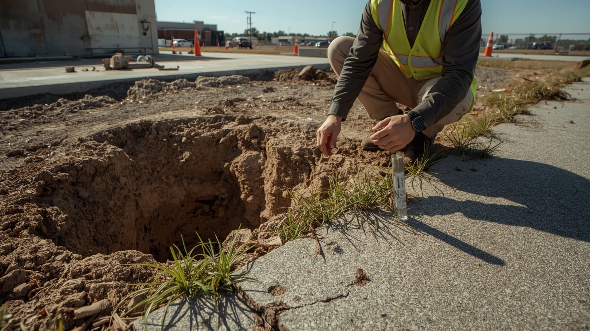
A parcel zoned for residential use but lacking public water and sewer may still require a well and septic system. A percolation test (perc test) determines whether the soil can support a septic system. If the soil fails, building a home on that parcel may be impossible even though zoning permits it.
Similarly, road frontage requirements in zoning codes mean a landlocked parcel — one with no direct access to a public road — may need an easement before any development can occur.
How to Assess Building Potential Before Closing
- Confirm zoning classification and permitted uses in writing from the planning department.
- Check for utilities — water, sewer, electricity, and gas connections to the parcel boundary.
- Verify road frontage and legal access — confirm a valid easement or direct road connection.
- Review environmental constraints — wetlands, floodplains, and protected habitats can restrict building even on properly zoned land.
- Order a boundary survey to confirm lot dimensions match the parcel description.
- Speak with a local land use attorney if the parcel involves complex zoning issues.
Frequently Asked Questions About Zoning for Land Purchases
Can I build a home on agriculturally zoned land?
In most jurisdictions, agricultural zones allow at least one single-family residence on the parcel — often called a farm dwelling. However, the lot size minimums are usually large, often 5 to 40 acres. Some agricultural zones restrict additional residential construction to prevent subdivision of farmland. Always check the specific zone code in your county.
What does “by right” mean in zoning?
A “by right” use is one that is automatically permitted under the zoning ordinance without needing special approval. If single-family homes are a by-right use in an R-1 zone, you can build one without a variance or CUP. This is the fastest and lowest-risk path to development.
What is nonconforming use in zoning?
Nonconforming use refers to a legally existing use or structure that no longer complies with current zoning rules but is allowed to continue because it predates the current ordinance. It is often called “grandfathered” status. However, if the nonconforming structure is destroyed or the use is abandoned, the property must comply with current zoning to rebuild or restart the use.
How long does rezoning take?
Rezoning timelines range from 3 months to 18 months or more depending on the municipality’s workload, the complexity of the change, and community opposition. Cities with active development pressure often have backlogs in their planning departments. Build a generous timeline into any land deal that depends on a successful rezoning.
Does zoning classification affect my ability to get a land loan?
Yes. Lenders treat zoning classification as a key risk factor. Agriculturally zoned land with no development potential is harder to finance and typically comes with higher down payment requirements — often 30% to 50%. Commercially or residentially zoned land in an active market is easier to finance because lenders see a clearer exit strategy if they need to foreclose.
What is a general plan and how does it relate to zoning?
A general plan (also called a master plan or comprehensive plan) is a municipality’s long-term blueprint for land use. Zoning codes are written to implement the general plan. If you want to rezone a parcel, your request must be consistent with the general plan’s vision for that area. Reviewing the general plan before pursuing a rezoning tells you whether your request has a realistic chance of approval.