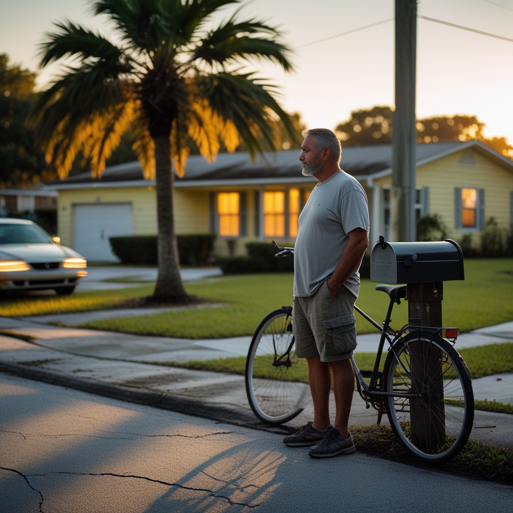
Thinking about buying a house or just curious about your current place? One thing you really need to look into is whether it’s in a flood zone. It sounds a bit scary, but honestly, floods can happen anywhere, not just next to a river. Even areas that seem pretty safe have a decent chance of flooding over time, way more than you might think. Knowing how to do a flood zone property check is super important. It helps protect your money and gives you peace of mind. We’ll walk you through how to figure this out, what the different zones mean, and what to do if your place is in a riskier area.
Key Takeaways
- Flood zones are areas FEMA maps out based on how likely they are to flood. This affects insurance and building rules.
- You can check your property’s flood zone using FEMA’s online Flood Map Service Center or by looking at local maps.
- An Elevation Certificate is important for knowing your property’s exact height, which can affect insurance costs.
- Talking to a flood insurance agent or reviewing real estate papers can give you more info on flood risks.
- If you think your property’s flood zone is wrong, you can ask FEMA to review it through a Letter of Map Change (LOMC).
Understanding Flood Zone Classifications
What Are Flood Zones?
Think of flood zones as a way to map out areas that have a higher chance of experiencing flooding. It’s not just about places right next to rivers or the ocean. Heavy rain, quick snowmelt, or even changes in the landscape can cause flooding in unexpected spots. The Federal Emergency Management Agency, or FEMA, creates these maps. They use historical flood data, how the land is shaped, and how water tends to flow to figure out which areas are more at risk.
Knowing your property’s flood zone is pretty important. It can affect things like whether you need flood insurance, how much that insurance might cost, and even what kind of building rules you have to follow if you want to build or make changes to your home. It’s a key piece of information for anyone buying, selling, or owning property.
High-Risk Flood Zones Explained
These are the areas where flooding is more likely to happen. FEMA calls these Special Flood Hazard Areas (SFHAs). If your property is in one of these zones, it means there’s at least a 1% chance of a major flood happening in any given year. That might not sound like much, but over the life of a typical mortgage, the risk adds up.
- Zone A: This is a general category for areas with a 1% annual chance of flooding. If you have a mortgage backed by the federal government, you’ll likely be required to have flood insurance here.
- Zone AE: Similar to Zone A, but these areas also have data showing how high floodwaters are expected to rise (the Base Flood Elevation, or BFE).
- Zone VE: These are coastal areas that face not only flooding but also the added danger of storm waves. Properties here also typically require flood insurance.
- Floodway: This is a specific part of a Zone A area. It’s where the water moves fastest during a flood. Because of this, there are usually stricter rules about what you can build or do in a floodway.
Low-To-Moderate Risk Flood Zones Defined
Even if your property isn’t in a high-risk zone, it doesn’t mean there’s zero chance of flooding. FEMA also maps areas that have a lower likelihood of flooding.
- Zone X (Shaded): These areas have a 0.2% annual chance of flooding, which is like a 1 in 500 chance. While flood insurance isn’t usually required by lenders, it’s still a good idea to think about getting it. Flooding can still happen here.
- Zone X (Unshaded): These are considered low-risk areas. The chance of flooding is pretty minimal. Most of the time, you won’t be required to get flood insurance if your property is in this zone.
It’s interesting to note that even properties in low-risk flood zones have a significantly higher chance of experiencing flood damage over a 30-year period compared to the chance of damage from a fire. This highlights why understanding flood risk, regardless of the zone, is important for property owners.
Here’s a quick look at the main zones:
| Zone Designation | Annual Chance of Flooding | Risk Level |
|---|---|---|
| Zone A, AE, VE | 1% (100-year flood) | High-Risk (SFHA) |
| Zone X (Shaded) | 0.2% (500-year flood) | Moderate Risk |
| Zone X (Unshaded) | Less than 0.2% | Low Risk |
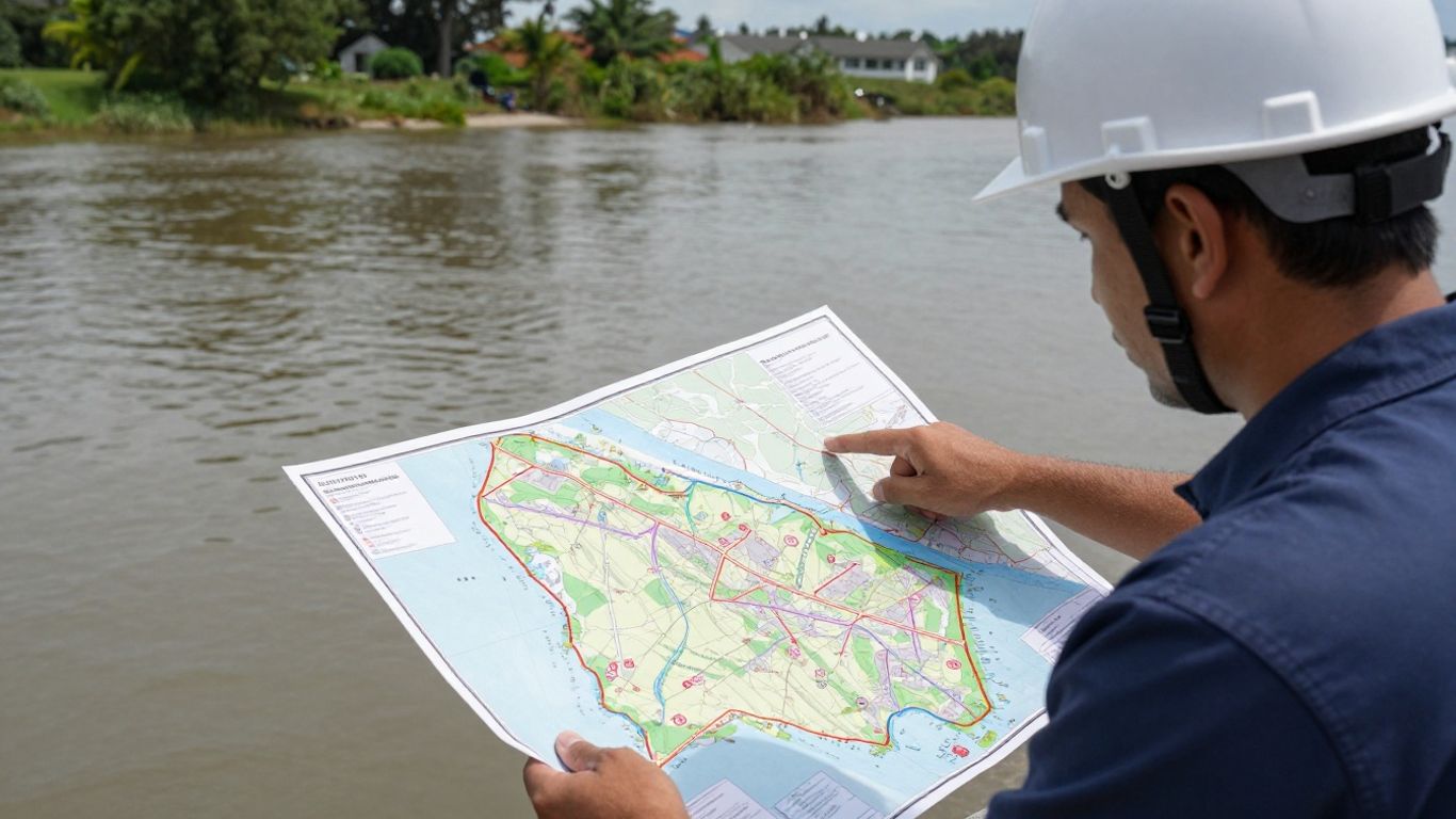
Performing Your Flood Zone Property Check
Figuring out your property’s flood zone status is a pretty straightforward process, but it’s one you definitely don’t want to skip. It’s like checking the weather before a picnic – you need to know what you might be up against. This step is key to understanding potential risks and what that might mean for your home.
Accessing the FEMA Flood Map Service Center
The Federal Emergency Management Agency (FEMA) is the main source for flood zone information. They maintain a Flood Map Service Center that’s easy to use. You can look up any address and see its flood zone designation.
Here’s how to get started:
- Go to the FEMA Flood Map Service Center.
- Type in the property’s address or its coordinates.
- You can then view an interactive map or download a PDF of the Flood Insurance Rate Map (FIRM) for that area.
- Use the map’s legend to figure out the specific flood zone your property falls into.
FEMA classifies zones like X (unshaded) for minimal risk, X (shaded) for moderate risk (think 1 in 500-year floods), and AE or A zones for high-risk areas (100-year floodplains). Coastal areas with wave action get a VE designation.
Knowing your property’s flood zone is more than just a formality; it directly impacts insurance costs and potential building regulations. It’s a foundational piece of information for any homeowner or buyer.
Utilizing Local and Regional Flood Maps
While FEMA maps are the standard, sometimes local or regional flood maps offer even more detail. Cities, counties, and local water management districts often have their own maps that might be more up-to-date or show specific local features like drainage systems.
To find these:
- Check your city or county’s planning department website. They often have GIS (Geographic Information System) tools available.
- Look for sections on flood maps or hazard information.
- Don’t hesitate to contact your local flood control district or water agency directly. They can be a great resource.
These local maps can be really helpful because they might reflect recent development, changes in the environment, or specific details about your neighborhood’s drainage.
Leveraging Online Flood Risk Tools
Beyond official government sites, several online tools can give you a quick look at flood risk. These often combine FEMA data with other information, like future climate projections.
Some popular options include:
- FloodFactor.com: This site offers a flood risk score for properties and can show you what flooding might look like in the future.
- MyFloodStatus.com: This is a paid service that provides official flood zone determinations, which can be useful for more formal situations.
- Local GIS Portals: Many towns and cities have their own interactive mapping tools that might include flood overlays along with other useful data like zoning or utility lines. You might find specific rules for building in areas like those governed by California’s land building restrictions.
These tools can offer a broader perspective and help you understand potential risks beyond just the current FEMA designation.
Gathering Essential Property Elevation Data
Knowing your property’s elevation is a big deal when it comes to flood zones. It’s not just about knowing if you’re in a flood zone; it’s about knowing how high your land is compared to potential floodwaters. This information is super important for a few reasons, especially when it comes to insurance and building.
The Importance of an Elevation Certificate
Think of an Elevation Certificate as a property’s flood report card. This official document shows the exact height of your building’s lowest floor in relation to the Base Flood Elevation (BFE). The BFE is the level floodwaters are expected to reach during a 1% annual chance flood event (often called the 100-year flood). Why does this matter so much? Well, if your lowest floor is above the BFE, your flood insurance premiums could be significantly lower. It also tells builders and architects if special flood-proofing measures are needed for any construction or renovations. Getting this right can save you a lot of money and headaches down the line.
Having accurate elevation data is key to understanding your property’s true flood risk and making informed decisions about insurance and development. It’s a proactive step that can protect your investment.
How to Obtain an Elevation Certificate
Getting an Elevation Certificate isn’t something you can usually do yourself. You’ll need a qualified professional to measure and document your property’s elevation.
Here are the common ways to get one:
- Hire a Licensed Professional: The most reliable way is to hire a licensed land surveyor, civil engineer, or architect. They have the tools and knowledge to accurately determine your property’s elevation and complete the certificate. You can often find local professionals through your city or county’s building department or by searching online for land surveyors near you.
- Check with Previous Owners: If you recently bought the property, the previous owner might already have an Elevation Certificate on file. It’s worth asking your real estate agent or the seller directly.
- Contact Local Government: Sometimes, your local building or planning department might have records or can guide you on how to obtain an Elevation Certificate, especially if there have been previous permits or inspections related to flood compliance.
Remember, an up-to-date Elevation Certificate is a valuable document. Keep it in a safe place with your other important property records.
Consulting Experts for Flood Zone Insights
Sometimes, looking at maps and online tools just isn’t enough. When you need a clearer picture of your property’s flood risk, talking to the right people can make all the difference. These professionals can help you understand the details and what they mean for you.
Working with a Flood Insurance Agent
Flood insurance agents are a great resource. They deal with flood risk every day and know the ins and outs of how it affects insurance policies. They can tell you if flood insurance is required for your property and what the costs might look like based on its flood zone classification.
- They can confirm if your property is in a high-risk area.
- They’ll explain the different types of flood insurance coverage.
- They can suggest ways to lower your insurance premiums, like making certain property improvements.
Talking to an agent early on can save you a lot of headaches and money down the line. They can also help you understand the specific requirements for Florida land zoning if you’re in that state.
Reviewing Real Estate Transaction Documents
When you buy or sell property, a lot of paperwork is involved. Flood zone information is often included in these documents, so it’s important to read them carefully. This is especially true if you’re buying a property.
- Seller’s Disclosure: This document usually lists known issues with the property, including its flood zone status. It’s often a legal requirement for sellers to disclose this information.
- Property Surveys: Sometimes, a survey might include details about flood zones or elevation.
- Closing Documents: Your title company or attorney will review various documents that might mention flood zone designations.
Pay close attention to any disclosures or reports that mention flood risks. Understanding this upfront can prevent surprises later on, especially regarding insurance and potential building restrictions.
Don’t hesitate to ask your real estate agent, lawyer, or the seller for clarification if anything in the documents is unclear. Getting a solid grasp of the flood risk before finalizing a transaction is key to making a sound investment.
Addressing Flood Zone Designation Concerns
Sometimes, you might look at a flood map and think, "Wait a minute, that doesn’t seem right for my property." Or maybe your property’s flood zone status changed, and you’re wondering what that means. It’s good to know that you can often question or try to change a flood zone designation if you have good reason and the right information. This section covers how to handle those situations.
Understanding the Letter of Map Change (LOMC)
A Letter of Map Change, or LOMC, is FEMA’s official way of documenting changes to their Flood Insurance Rate Maps (FIRMs). Think of it as an amendment or revision to the official flood map. There are different types of LOMCs, but the ones most relevant to property owners are usually Letters of Map Amendment (LOMA) and Letters of Map Revision (LOMR).
A LOMA is issued when a property owner provides evidence that their specific property is actually outside the mapped Special Flood Hazard Area (SFHA). This often happens if a property is at a higher elevation than the mapped flood levels. A LOMR is typically used when changes are made to the flood hazard information based on new data, like updated studies or flood control projects that have altered the floodplain.
It’s important to remember that a LOMC is a formal document. If you receive one that changes your property’s flood zone status, it can affect your flood insurance requirements and costs. Always keep these documents with your property records.
Steps to Request a Flood Zone Map Amendment
If you believe your property has been incorrectly placed in a high-risk flood zone, you can request a review from FEMA. This process usually involves submitting an application and supporting documentation. Here’s a general idea of the steps involved:
- Gather Evidence: The most critical piece of evidence is usually an Elevation Certificate. This document, completed by a licensed surveyor or engineer, shows the elevation of your property’s lowest floor relative to the Base Flood Elevation (BFE) for your area. You’ll also need supporting documents like site plans, surveys, and possibly data on flood control structures if they protect your property.
- Determine the Correct Application: Based on your situation, you’ll need to figure out if you’re applying for a LOMA (for a single property) or a LOMR (if there are broader changes to the map). FEMA’s website has detailed guides on which application to use.
- Submit Your Application: Fill out the required application forms completely and accurately. Attach all your supporting evidence. Applications are typically submitted to FEMA.
- Wait for Review: FEMA will review your submission. This can take several months, as they need to verify the data and determine if a change is warranted. They may ask for additional information during this period.
- Receive the Determination: If your request is approved, FEMA will issue a Letter of Map Change. This document will specify the new flood zone designation for your property or area. If denied, they will explain the reasons why.
It’s often a good idea to work with a professional, like a surveyor, engineer, or a flood mitigation specialist, when preparing and submitting a LOMC application. They understand the requirements and can help ensure your submission is complete and accurate, which can make the process smoother and increase your chances of success.
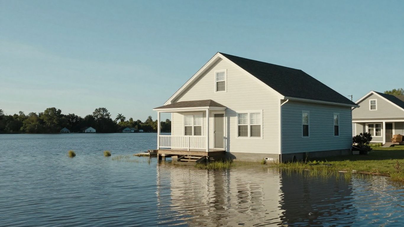
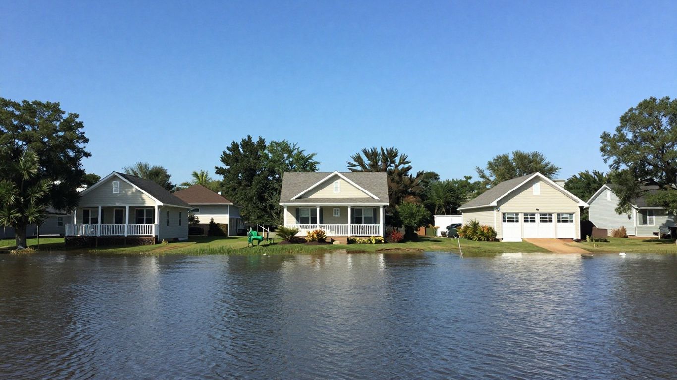
The Impact of Flood Zones on Your Property
So, you’ve figured out your property’s flood zone designation. That’s a big step! But what does it actually mean for you and your home? Knowing your flood zone isn’t just about avoiding surprises; it directly affects your wallet, how you can build or renovate, and even what your property is worth down the line.
Insurance Requirements and Costs
This is often the first thing people think about, and for good reason. If your property is in a high-risk flood zone (like an AE or VE zone), and you have a mortgage from a federally regulated or insured lender, you’ll almost certainly be required to have flood insurance. This isn’t usually covered by your standard homeowner’s policy, so it’s an extra cost to factor in.
Even if flood insurance isn’t mandatory for your specific situation (like if you’re in a moderate-risk zone or own your home outright), it’s still something to seriously consider. Remember that statistic? Low-risk areas still have a significant chance of flooding over time. The cost of flood insurance varies based on your zone, your home’s elevation, and the coverage you choose. It’s wise to get quotes early on.
Construction and Development Regulations
Living in a flood zone, especially a high-risk one, means there are rules about how you can build or make changes to your property. These regulations are put in place to help protect your home and the surrounding community from flood damage.
- Elevation Requirements: You might need to build or elevate structures to a certain height above the expected flood level (known as the Base Flood Elevation or BFE). This can add significant costs to new construction or major renovations.
- Building Materials: Regulations may specify the use of flood-resistant materials in certain areas of your home, particularly in basements or lower levels.
- Permits and Approvals: Expect to go through extra steps to get permits for any construction or development. Local authorities will want to ensure your plans meet flood mitigation standards.
Local governments often have their own ordinances that can be stricter than federal guidelines. Always check with your city or county planning department before starting any project.
Long-Term Property Value and Resilience
Your property’s flood zone designation can influence its market value. Homes in high-risk flood zones might be harder to sell or may command a lower price compared to similar homes in lower-risk areas, simply because of the associated insurance costs and potential for damage.
However, taking proactive steps can make a big difference. Properties that are well-maintained, have flood mitigation measures in place (like proper drainage or elevated foundations), and are located in communities with good flood management infrastructure tend to hold their value better. Investing in resilience isn’t just about protecting your home; it’s about protecting your investment for the future.
Wrapping Up: Your Flood Zone Check
So, we’ve gone over how to figure out if your place is in a flood zone. It might seem like a lot, but honestly, knowing this stuff is pretty important. Whether you’re buying a house, thinking about building, or just want to be prepared, checking those flood maps is a smart move. FEMA’s website is the main place to start, but don’t forget your local town or city might have extra info too. And hey, if you find out you’re in a riskier area, looking into flood insurance and having a plan for emergencies is just good sense. Being ready for whatever nature throws your way is always a good idea.
Frequently Asked Questions
What exactly is a flood zone?
A flood zone is basically a map that shows areas where flooding is more likely to happen. The government, like FEMA, creates these maps to help people know if their home or property might be at risk. They divide areas into different zones based on how often flooding might occur, which can affect things like insurance.
How can I find out which flood zone my house is in?
The easiest way is to use the FEMA Flood Map Service Center online. You just type in your address, and it will show you the official flood map for your area and tell you which zone your property is in. Sometimes, your local town or county office also has this information.
Do I really need flood insurance?
If your house is in a high-risk flood zone and you have a mortgage from a federal agency, then yes, flood insurance is usually required. Even if it’s not required, it’s often a smart idea to get it because floods can happen anywhere, and insurance can save you a lot of money if the worst occurs.
What’s the difference between Zone A and Zone AE?
Both Zone A and Zone AE are considered high-risk areas where flooding is likely. The main difference is that Zone AE maps also show the expected height of floodwaters, called the Base Flood Elevation. Knowing this height is important for building and insurance purposes.
Can my property’s flood zone status be changed?
Yes, it’s possible! If you think your property is in the wrong flood zone, you can ask FEMA to review it. You’ll need to provide proof, like a survey or an elevation certificate showing your land is actually at a lower risk. This process is called a Letter of Map Change (LOMC).
What should I do if my property is in a high-risk flood zone?
First, make sure you have adequate flood insurance. Then, consider ways to make your property more resistant to flooding. This might involve elevating your home, using flood-resistant materials, or improving drainage. Talking to an insurance agent or a flood-plain expert can give you the best advice.